Sunday, July 23, 2006

Colorado Trail Section 23


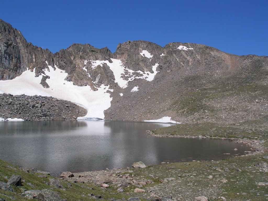
Ah, finally. Nick and I resumed our quest to complete the Colorado Trail with a trip to section 23 in the San Juan Mountains. We decided to make a big loop up Lost Trail Creek, across section 23, then back down the dirt road to the Lost Trail Campground and the Rio Grande Reservoir. I was imagining the ascent up the Lost Trail would find us pushing our bikes most of the way, but it turned out to be a nice ATV trail. There was lots of uphill for sure, but also gentle rolling in valley. The last push to the pass was the toughest. On the way I seen a nice four point buck.


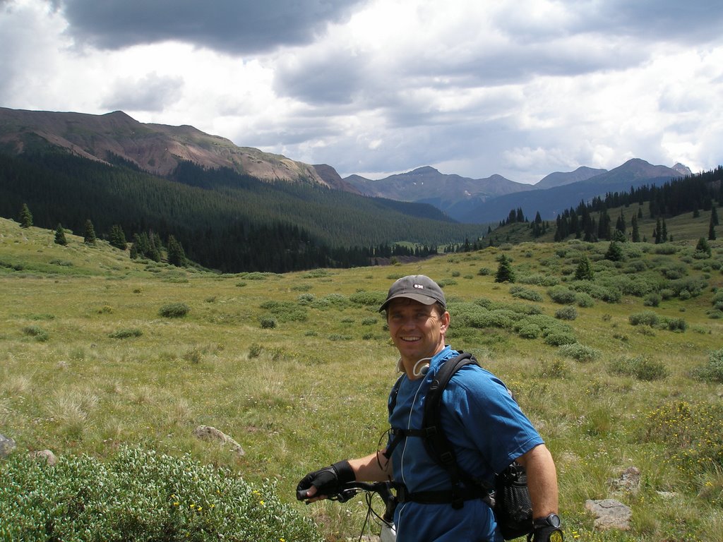
When we got to the pass, we found no trace of the camp we had to abandon last October. Check out our epic here. Finally on the Colorado Trail, we enjoyed a nice bike ride down into the most isolated section on the entire C.T. If you don't mind a climb, I would recommend not taking the bike detour mentioned in the official guide.


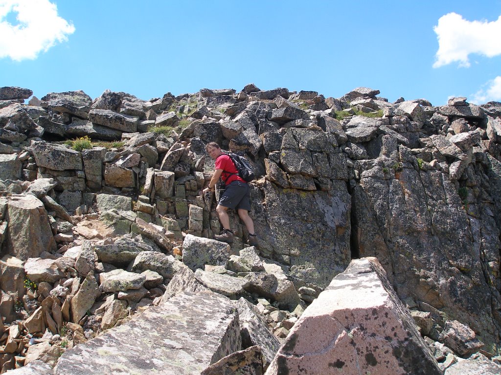
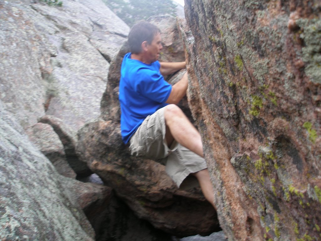
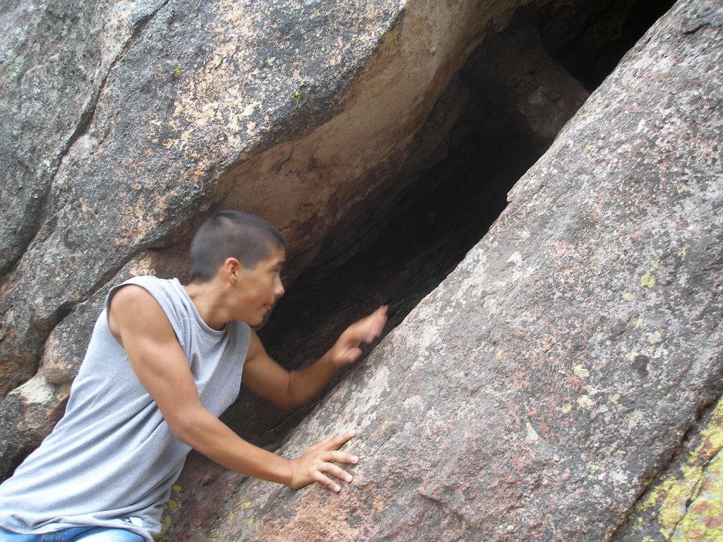
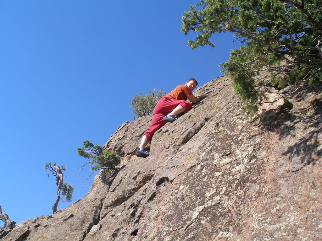
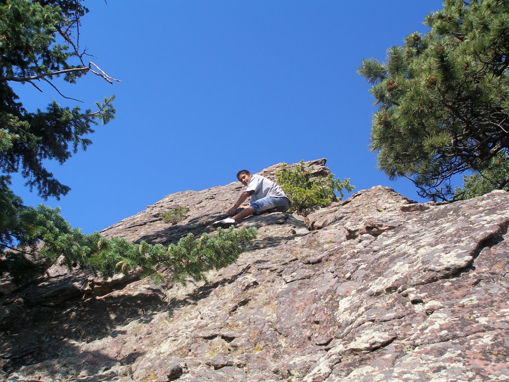
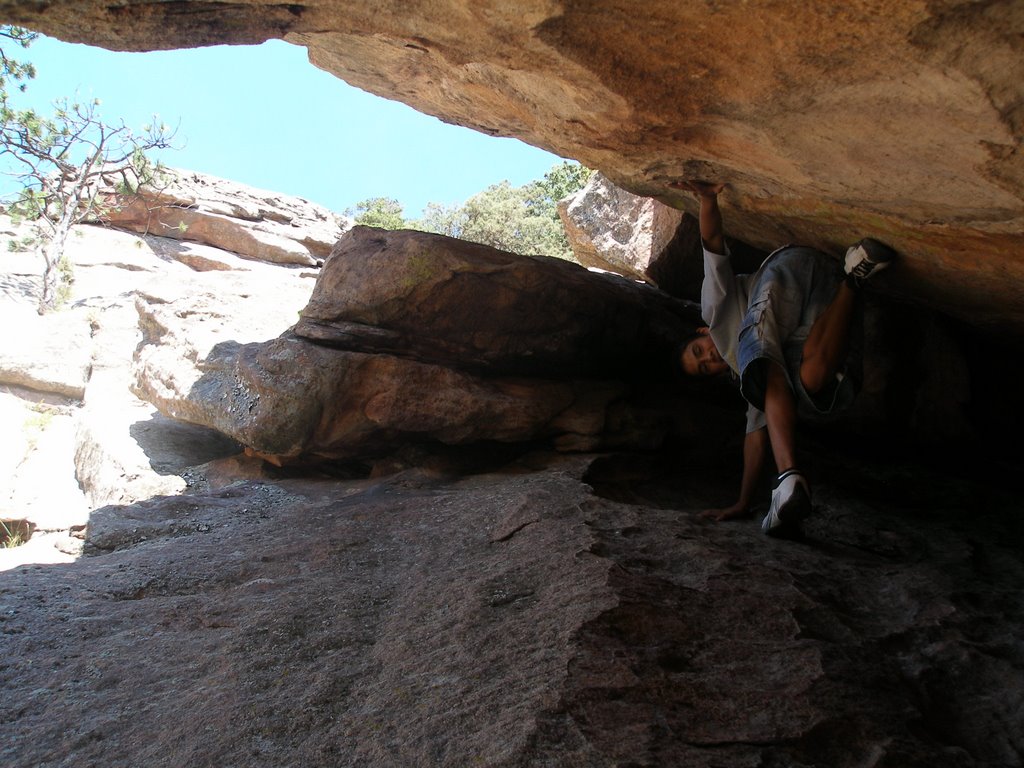
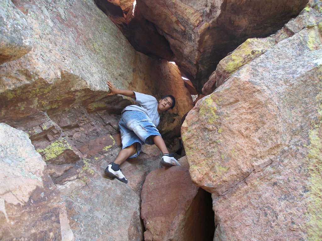
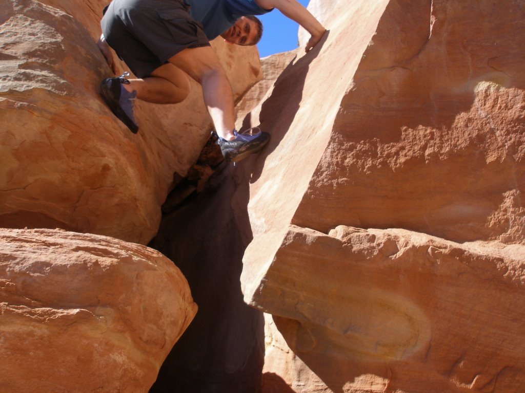
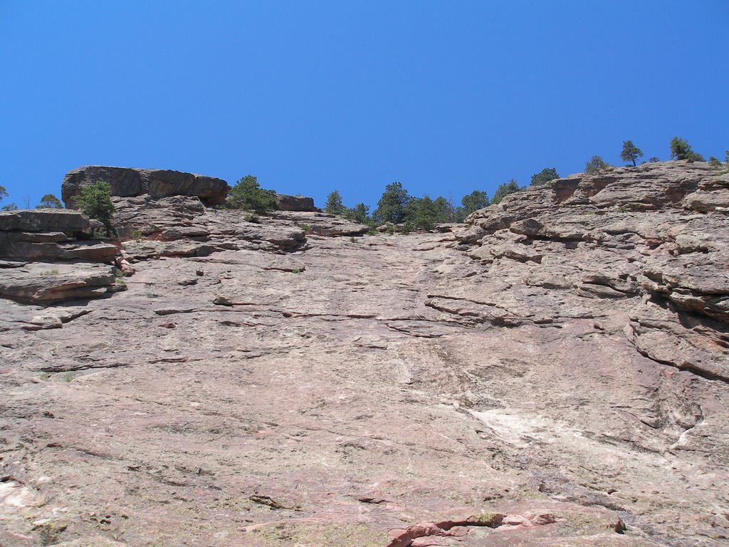
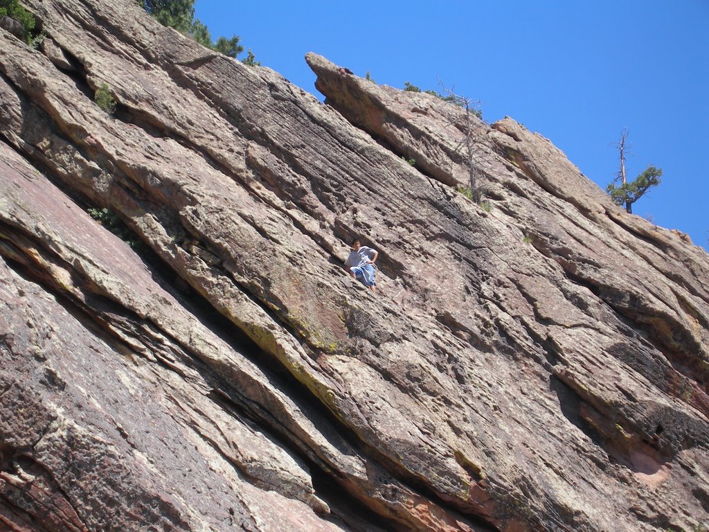
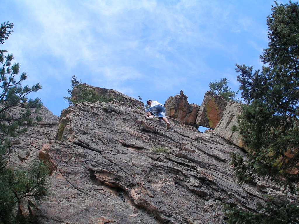
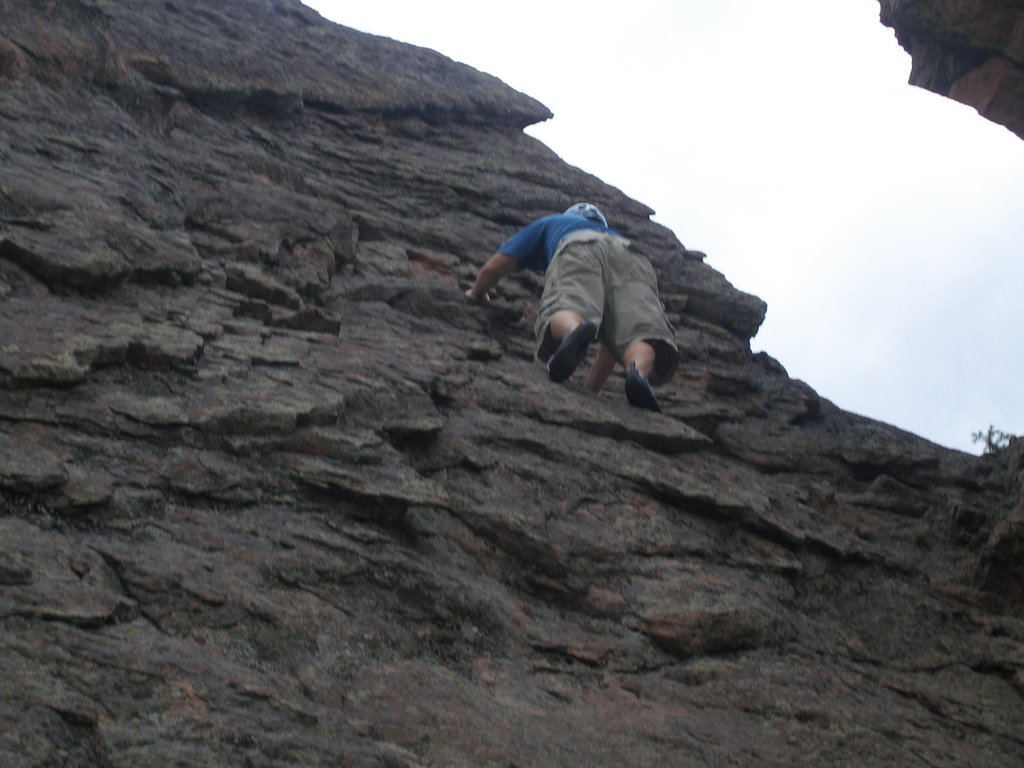
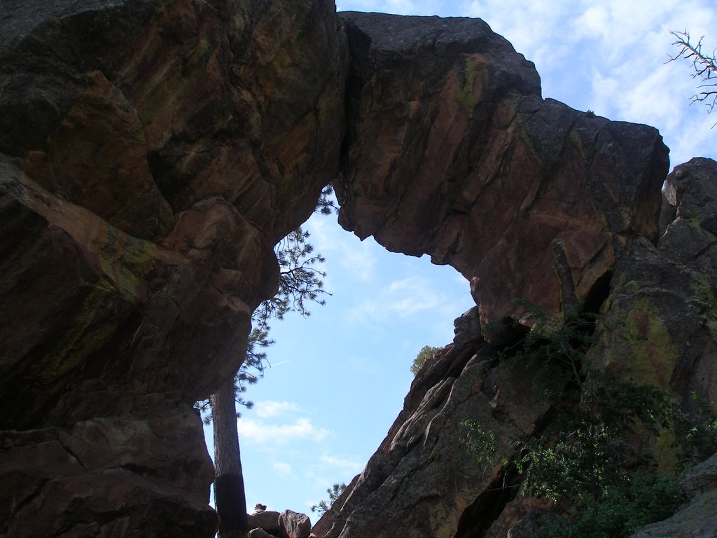
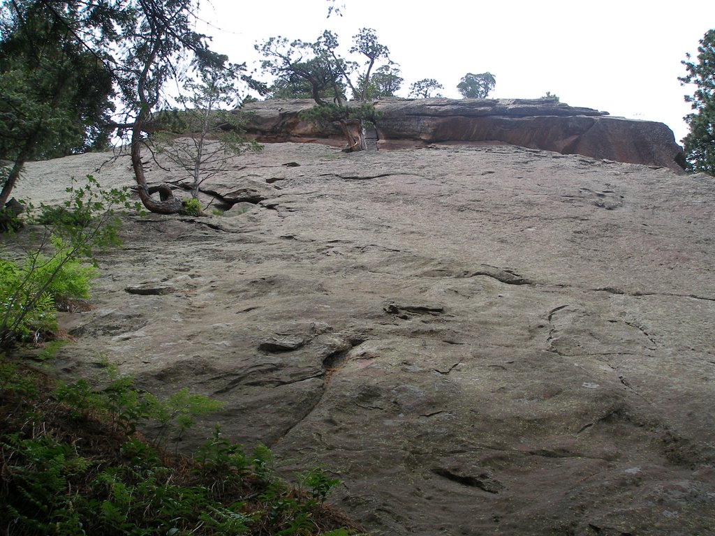
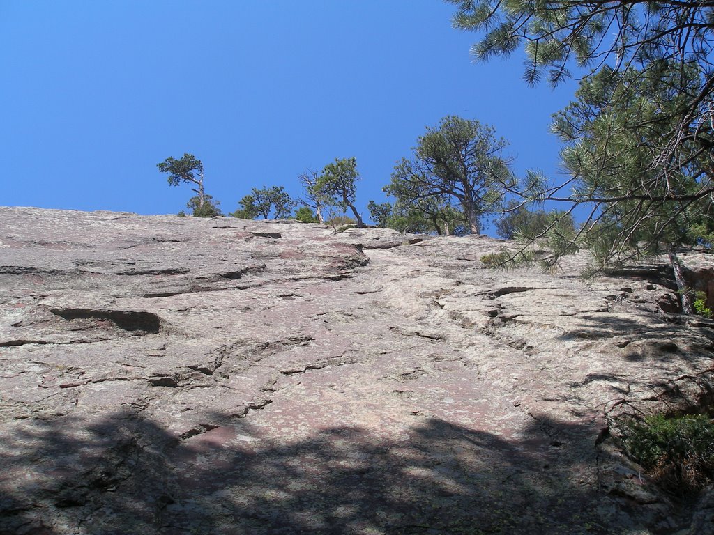
The pass is guarded by an army of goblins. These crags are just begging to be climbed, so I decided to give one a scramble. The rock is a bit rotten so route finding is a slow go. Check out the arch crag I climbed.


After pushing our bikes the better part of three miles, we finally made it to the pass and our reward: the descent. It doesn't get better than this. A very fun downhill ride into a beautiful valley. I did wreck on a steep stretch covered in baby heads. When I landed I bent my first two fingers backwards, swelling my hand and making it hard to brake.

There are several stream crossings on this descent. I tried to cross every stream, but wrecked twice on the deeper crossings. Although secluded we did encounter many fishermen, a couple of motorcyclists, and plenty of hikers.


At the end of CT 23 we realized it was 10 miles back to rio grande reservoir and our camp. Nick had seriously under estimated the length of this section (Nick has this tendency. It's the reason Dalton doesn't go with us anymore!) The road starts out with a long uphill slog for first couple of miles, but then its mostly downhill and fun ride on a wide dirt road. Flying down the hill, I came upon a nicely banked corner. I thought I would whip around it, but fell again on the damn gravel. I lost a little hide on this one.

All together it was a thirty mile trek, but we weren't overly tired at the end. I must say this was a great day and a truly spectacular ride. Five sections to go!

Tuesday, July 18, 2006

Mt. Neva

On Sunday I took a trip to the Indian Peaks Wilderness for a scramble up the north ridge to Mount Neva. Starting from the Buckingham Campground (also called the Fourth of July Trailhead) its a hike all the way up to Arapahoe Pass. However, I mistakenly took the diamond lake trail and it turned out to be a great move. Although the going got swampy after leaving the trail and heading for the ridge, I soon came upon a cabin and an old mine. The bushwacking was Class 2+ allowing as much rock scrambling as you want to add. I hit an impass at a fast moving creek that was at least 3 feet wide. After contemplating a wade, I decided to jump the creek since the water was moving fast. Bad move. I tweaked my back but good on the landing. In hind sight I should have removed my backpack before the hop.

In the cliff bands just below Lake Dorothy I happened upon a plane crash. Check out the picture... it looks to be a Cessna from the flaps. The scramble is fun up to Lake Dorothy and a good warm up for the ridge to come.

Finally on North Ridge, the first scramble continues your preparation for the Class 4 scramble above. The scramble on the North Ridge looks most daunting from the lake (see picture), but gets less intimidating the closer you get. Once on the crux it is pure fun. The downclimb immediately following the crux forces you to the left.

The main crux, downclimb and second crux constitute the highlight of the trip so enjoy it! The final scramble is anticlimatic, but if your adreneline is pumping it provides a gentle let down as you head for the summit. At least I felt confident enough to get in the picture :-)

I ran out of camera battery on top of Mt. Neva so no photos at the summit. I followed Dave Cooper's advice from his book Colorado Scramblesand found a descent that split two lakes below. This downclimb is a fun scramble over a vast boulder field.

The boulder field and snow fields continue on long trek back to Arapahoe Pass trail. I stayed high which led me to one more challenging downclimb over wet rock caused by melting snow. All in all this scramble tops both the Kelso Ridge on Torres and Father Dyer Peak. For me it ranks just below the scramble on the Crestone Peak for challenge and fun.

Sunday, July 09, 2006

The Second Flatiron


Yesterday Matt and I took a trip to the second flatiron. As our confidence grows, we have started scrambling on a few Class 4 rocks. We approached this flatiron from Chautauqua Park and like last time took the wrong trail initially. We took the West Side trail which cuts off most of the scramble.


We still managed to get in a couple hundred yards of climbing in a steady drizzle. By staying on the north west ridge you can escape to the north in many spots. It is a fun scramble and with fewer holds than El Camino Royale, it makes route finding a good mental drill.


After a second go at this ridge, Matt and I decided to find the true nadir of the face as Richard Rossiter describes in Rock Climbing the Flatirons. I didn't know the definition of nadir: the lowest point of anything. Well we found the nadir, but by then the drizzle had turned into full blown rain. Even the flatirons turn into slickrock in the rain. The other definition of nadir seemed appropriate in this case: an extreme state of adversity.


We decided to give it a try anyway, and started climbing. There were a couple of tricky spots and Matt's tennis shoes did not grip as well as my 5.10's. We made it up about half way on the climb called Freeway. There are no easy escape routes here, but Matt and I downclimbed a small gulley which ended in a nasty crack climb. Muddy and wet, we inched our way down to safer climbing. Quite fun.


With the rain steady on, we decided to not push our luck further and instead just hike on up to the Royal Arch. Matt climbed his west side under chimney again. Our climbing on the second was to the right and below the large block called the pullman car in this photo.

El Camino Royale


The El Camino Royale climb is a scramble up the Regency Flatiron. This rock is located just below (east of) the Royal Arch in Boulder's Flatirons. Matt and I approached this flatiron from the Chautauqua Park trailhead, but a shorter approach would be from the NCAR trailhead as described in Gerry Roach's Flatiron classics. From NCAR take the Mesa Trail north until you see a trail that heads for the Regency.


This scramble is rated class 3, the holds are plentiful and the climbing is superb. We stayed on the northeast ridge on our first ascent as recommended by Gerry and there was never a time when I felt nervous. Matt is much faster going up than I am so he led the way. In contrast, I am a bit faster descending than Matt is.


Because we took the long way there, we didn't have a lot of time, because we wanted to spend some of Indepence Day with Michelle. So rather than a full second ascent Matt decided to see how far he could go in ten minutes. He made it an impressive 300 yards! But it made him very tired. I climbed a bit on the south east face. We met and descended a fun chimney as you can see in the picture.


Matt wanted to check out Royal Arch so we hiked up to the south of the Regency. We probably could have scrambled the royal road again and downclimbed to the west after seeing it from below. Matt climbed the class 3 east side of the Royal Arch and also climbed the chimney underneath the west side.

Saturday, July 01, 2006

Rough Canyon


Another weekend in Grand Junction and another scramble up Little Park Road. This time Matt, Gracie and I went to Rough Canyon. The trail descends a gnarly old 4x4 trail and splits. Going left leads to rough canyon or right leads to the micah mines.

We hiked for a bit and found some nice boulders to try. Matt showed me how to get up the boulder in this picture. He had to transfer his hands a couple of times in the crack, smear quite a bit, and finally use his knees to conquer it.


The funnest place we found was a chimney climb. Chimneys are great because they give you that false sense of security that you can always use your muscles to avoid falls. As we climbed, of course some hikers had to happen by which added a nother worry to my mind: Gracie. She was a good dog and didn't bother them.


As we were descending the chimney, Matt stepped on a chock-stone and it gave way. It fell, but luckily Matt didn't. The descent seemed to worry Matt more than the ascent. For me it was the reverse.


The final fun spot was a small overhang that we found. Matt tried to climb it for awhile and couldn't quite get it. Then the old man had to show him how it's done. The key was foot placement, smearing, and good old fashion muscle. It made us even after he schooled me on that boulder.

Ribbon Trail


Michelle needed to go to Grand Junction to care for her mom and grandma, so the past two weekends I have been travelling from here to there. This hasn't stopped Matt and I from scrambling though.


I didn't have a guide book on good climbs in Grand Jct., so I just had to use my instincts and head for the crags up Little Park Road. They sure have done a lot of improvements since I was a kid growing up here.

The first spot I tried was the Ribbon Trail. This trail leads out onto some very large slick rock that would be fun to mountain bike on. Instead of following the trail, head west toward the cliffs probably 1,000 yards from the parking lot. All along this canyon are places to scramble. The rock is much softer than the Flatirons.

Check out the pictures. Does anyone know the names of these climbs?

Shannahan Crags & The Slab


After the fun we had at the Harmon Cave, Matt and I couldn't wait to do more scrambling in the Flatirons. We researched the Flatiron Classics book by Gerry Roach and decided to try the Shannahan Crags. These crags provide over 600 feet of consistent scrambling.

How to get there: Don't park at the end of Hardscrabble Road as this book suggests, there is no longer public parking here. Instead continue past Hardscrabble and either park on Lehigh Street or Lafayette Drive. Take Broadway to Greenbriar. Greenbriar turns into Lehigh in Boulder.


Approach: Follow the South Shannahan Trail until it reaches the Mesa Trail. Make a right on the Mesa Trail for a couple hundred yards and turn left when you reach a nice park. If you follow this walk in the park you will avoid the steep canyons and scree and come out at the base of the crags. (We learned this the hard way, by going south on the Mesa Trail, then cutting up to the Sphinx. This forced a bush-whack over a steep canyon.)


The South Shannahan crag is a fun and exhilirating scramble. The small cliffs near the top are the crux, but aren't as hard as they look. The holds are fairly consistent and frequent. Lot's of fun.


The North Shannahan crag is a little more challenging. When Matt and I first approached it, we weren't sure it was it because of the difficulty. We continued on
to the Slab. We didn't know it was the Slab, but the climbing looked easier. Turns out the routes on the South end are rated 5.0. Matt went to the right on a route called Syzygy and I think I took Up and Left. A fall from here would be scary, but not fatal. The rock isn't too steep. We escaped from the top and took a long hike around the north end of the slab. The vegetation is thick on the front side of the slab and it took us a while to reach our staging area (and the water!)

Friday, June 16, 2006

Harmon's Cave


Well my son Matt came to stay for the summer and we agreed to go for a scrambe at Harmon's Cave. Gerry Roach's Flatiron Classics book said there was a lot of good scrambling in this area with six different summits to climb. We brought Gracie along because she loves to hike and I figured she would be okay at the base with two of us there.

We approached the area via the NCAR trailhead. The hike from here isn't very far and Gerry's book described the take off point well: leave the Mesa Trail 100 feet south and uphill from its junction with the Bear Canyon Trail.


As we approached Harmon's Cave we found that the cave itself has an iron grate covering the entrance. Also they have closed off all climbing within 100 feet of the cave. We were disappointed, but still found plenty of scrambling without encroaching on nesting raptors.

Most of the climbs are less than 100 feet so you can try many different routes and Matt and I explored them well. The arch that Gerry said you can climb thru proved too small for me. Check it out in Matt's picture.


The scramble of note for the day is when we made our way to the highest summit of the six. To avoid the cave area we picked our way slowly on the ridge. The final pitch has some nice jug holds that make the ridge easy but exhilirating. On the way back to the trail we bushwacked a bit and had to cross a long expanse of scree. Not fun for Gracie!

Saturday, June 10, 2006

Royal Arch


Another weekend and another chance to go hiking and scrambling in the Flatirons. This time I chose a trip to Royal Arch and a bit of scrambling in Fern Alley. I was hoping that the trail was not blocked off like on Mallory Cave. Luckily it wasn't, but much of the south side of the third flatiron is. Nesting raptors you see.

As you take the Royal Arch trail from Chautauqua Park it climbs to the west and there are some great views of the Flatirons. The route thru Bluebell Canyon leads to Sentinel pass. When I started to descend from the pass it made me a bit nervous wondering if I was on the right path. Luckily I was, so don't let the descent fool you. The final step ascent to Royal Arch involves many switchbacks and steep hiking.

The Royal Arch itself is not like those around Moab, but is cool nonetheless. Check out the picture. I did have great views of downtown Denver.


I hiked back down to the top of the switchbacks and left the trail in search of Fern Alley. I climbed up the north side of the fourth Flatiron, but I'm not sure I ever found it. I did a bit of boulder scrambling, crossed the top of the fourth, and then started back towards the trail. About halfway down I found a nice scrambling rock that had slings on some trees.


I donned my climbing shoes and gave it a go. It was the perfect challenge on the climb up and I had quite alot of fun. I climbed along the shelf at the top of the slab until I could not go any farther. This forced me to downclimb about half of the route. Luckily there was a nice crack, but it was still a nervous time. At the bottom I was relieved and very happy. Quite a fun day.

Sunday, June 04, 2006

Mallory Cave


Gracie and I went for a hike to the Mallory Cave in the FlatIrons above Boulder. I also wanted to do a bit of scrambling. I found a great little book in the library called Flatiron Classics: A Guide to Easy Climbs and Trails in Boulder's Flatirons which describes many cool climbs that nobody knows about.

This was my first hike in the Flatirons and I must say I was very pleased with the area. It is a very beautiful and peaceful place so close to Denver. Once we got to the cave we found that the area is closed until October so as not to disturb the bats. I guess we will return in October! Here's a picture of Gracie trying to scramble... she whined so I had to help.


With the first goal unattainable, Gracie and I headed on up the trail to look for a nice rock to scramble on. At the top I found a nice rock and slipped on my climbing shoes. Check out the photo. I was scrambling up a section that was at the edge of my comfort zone, when a couple of hikers approached our area. Gracie was not on a leash and was starting to whine because she couldn't see me. I couldn't move down the rock quickly, so I had to scramble up instead, swing from a small tree into a crevice so I could get down and collect Gracie before the hikers approached. Quite a n adventure.