"The best-laid plans of mice and men often go awry" -- adapted from a line in “To a Mouse,” by Robert Burns
Nick and I decided to push our luck and try one more trip on the Colorado Trail this year. Our quest was sections 22 and 23 along the continental divide above Lake City. The weather report said rain/snow late Sunday, so we figured it might work. We left Friday afternoon and set up camp at the top of Wager Road: the midpoint between 22 and 23.

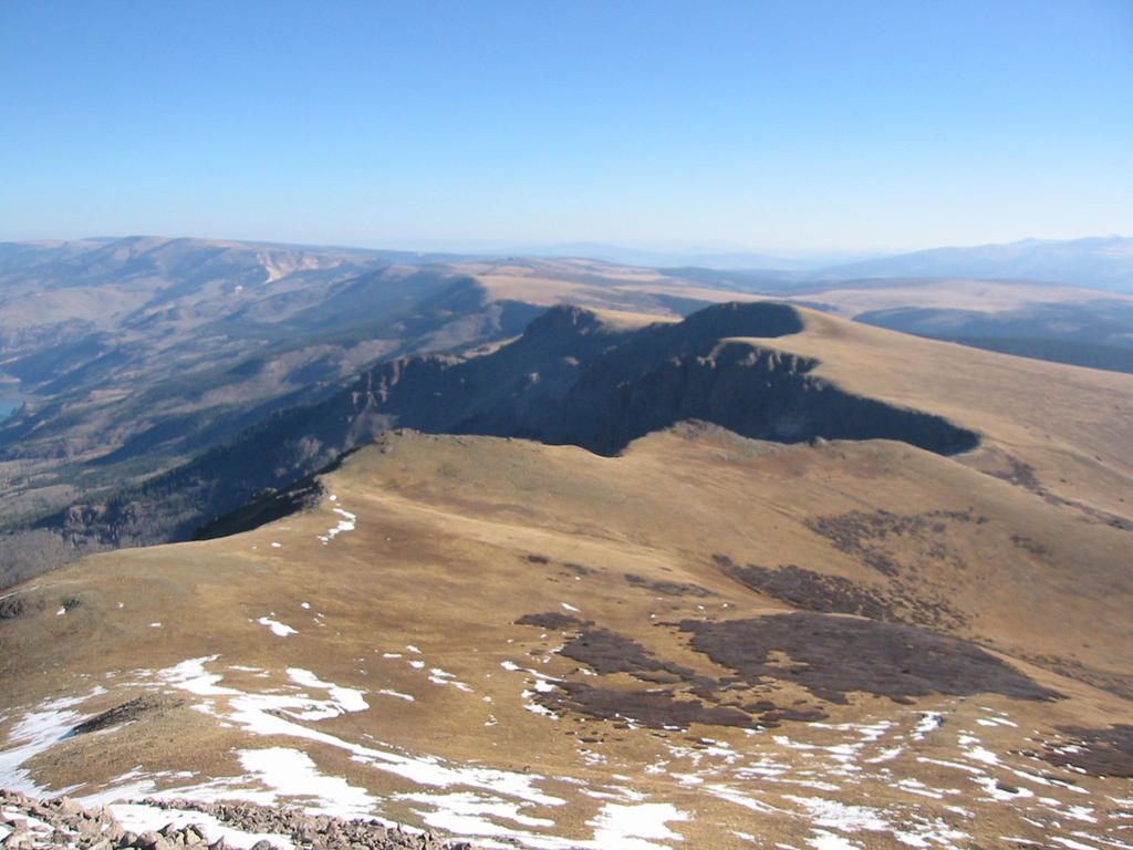
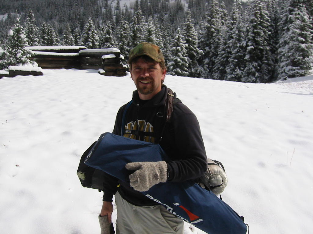
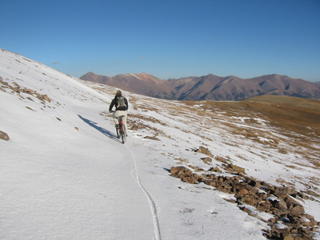
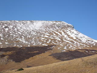
The first picture is of the Wager 4WD road. The second shows the entire first half of the section. The trail follows this ridge as far as you can see in the picture then drops down to the right. The third picture shows me riding across some crunchy snow. Great fun.
How do you hike two sections without having to go out and back, plus have only one camp setup? With two vehicles you can do it with a bit of travelling. Our plan was to position Nick's car at Spring Creek Pass and bike there from the
midpoint camp. Then drive his car to the base of Wager Road where we would take my atv back up to the camp and get my truck. Then we would reposition Nick's Avalon at the end of Section 23 and drive together in my F150 back to camp. Finally after biking 23, we would arrive at Nick's car, drive it back to Wager Road and gather all of our stuff and back to Denver.
Mishap #1: I could not get my atv started Thursday night so we decided not to take it. This meant that I would have to hike up to camp since Wager is definitely 4WD and no place for an Avalon.
Biking Section 22 is great. The Colorado Trail
guide book recommends a detour around this sections, but I would recommend that you go ahead and bike it. I don't believe we did any damage to the high alpine environment and the ride is better than many other sections we have done where you push your bike more than ride it. If anyone can clean this section though, my bike helmet is off to you! We did the section backwards (west to east) because it is loses more altitude this way than it gains. Even though you start out going uphill, after about two miles it is mostly a downhill ride. The views from this section are just amazing. We had the entire day to ourselved until about a mile from Spring Creek pass where we met up with a couple of hikers. The fourth picture shows the steepest hill in the section. It was too steep and the switchbacks too sharp for us to ride.
We arrived at Spring Creek pass, loaded the bikes and drove back up the Lake San Cristibol road. I then started my five mile hike back up to my truck while Nick rested at his car... old man you know ;-). At about three miles I met up with some guys from Colorado Springs who were setting up hunting camp a week early. I was still feeling good, so I didn't bother them for a ride to the top. I made it to camp, just at the point where I was getting a bit tuckered out. The weather was starting to roll in, but I didn't think much of it at this point. I drove my truck back down and we started the caravan to position Nick's Avalon at the Lost Trail Trailhead above Rio Grande Reservoir.
Mishap #2: Now it started raining. By the time we made it back to Wager Road it had been raining for a couple of hours. I could not get my pickup more than about half way back up the 4wd road to our camp, so we had to turn around and spend the night in Lake City. Finding a room at 10 PM in this town is not easy in early October. We happened to be here just in the off season. It was after all the Texans had gone home for the winter, and just before hunting and snowmobile seasons. We finally roused a Frenchman at the Moose Lodge to rent us a room. Very nice fellow.
Mishap #3: I was hoping that the ground would be frozen the next morning, but it rained all night in Lake City and snowed 6 inches on the mountain. Having no better plan, we decided to try and get my truck up the road anyway. We didn't even make it as far as the night before. This time, however, I got my truck stuck while trying to turn around. When will I learn that the ground is much less packed just off of the road? Nick tried to talk me into backing down to a pull out, but I didn't take his advice. It took us some time, but eventually we dug enough mud and placed enough rocks to get the pickup out. Luckily there was a big flat boulder just at the edge of the cliff I could use!
Mishap #5: We then started to get concerned about Nick's Avalon at the top of a 19 mile dirt road. Would he be able to get it out if the weather kept up? We decided the best action would be to get it now. We started up Slumgullion Pass, but my buddies at CDOT had not plowed the road. Just below the Lake San Cristobal overlook, a lady had spun her car out in the snow. We helped her get it pointed back down the hill and decided not to try to make it over the pass until the plows went through.
Mishap #6: We then decided to try and rent a 4 wheeler, since I didn't take mine. Nobody was open to rent, so we decided to just hike up to camp and salvage what we could carry.
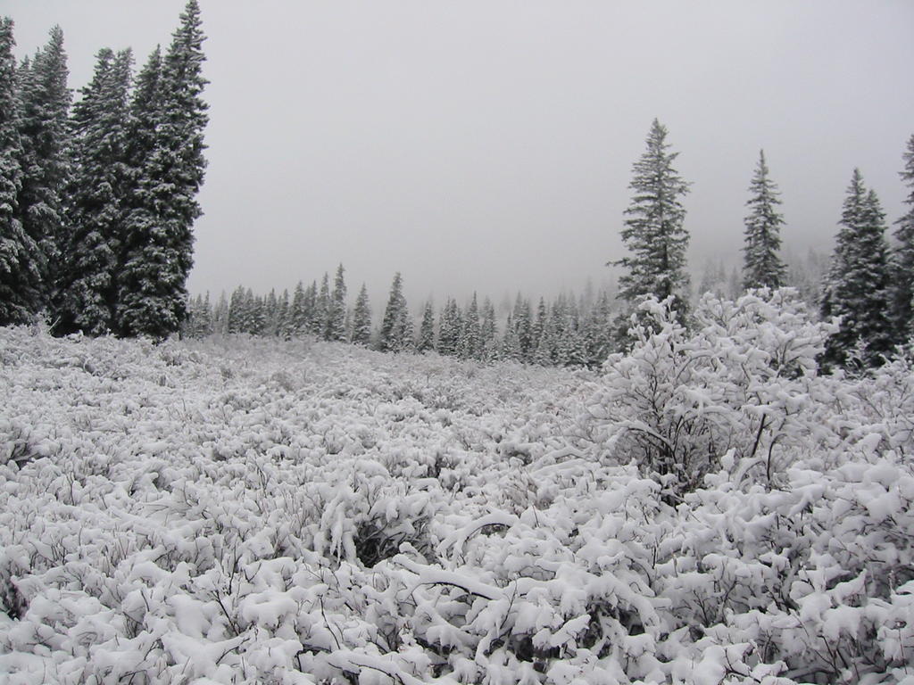
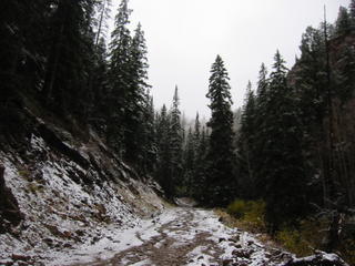
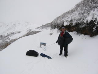
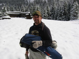
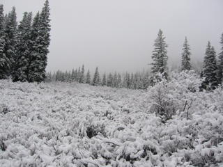
So we started the 5 mile hike up, 3,000 ft elevation gain. We salvaged about half of our stuff, but Nick's tent had broken in the wind and snow. We dragged my camp box and carried the rest back down to the truck. 10 miles round trip! The final three pictures set the scene for our rescue mission. The last picture is my favorite.
Then we spent 7 hours in a snowstorm getting back to Denver.
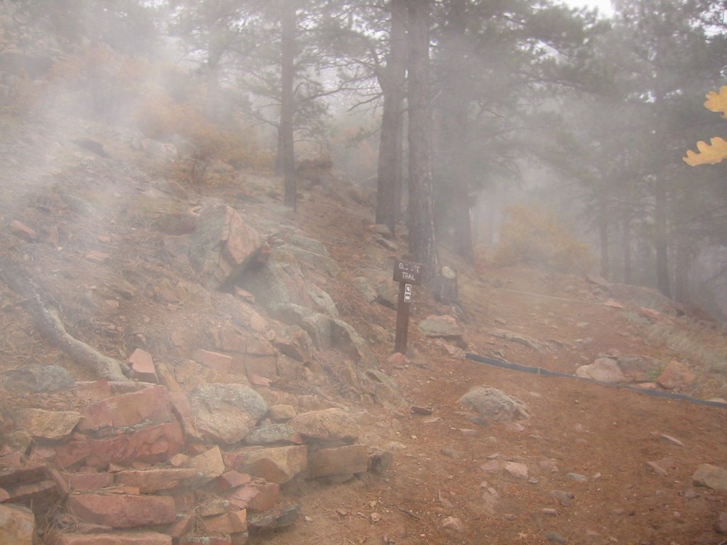
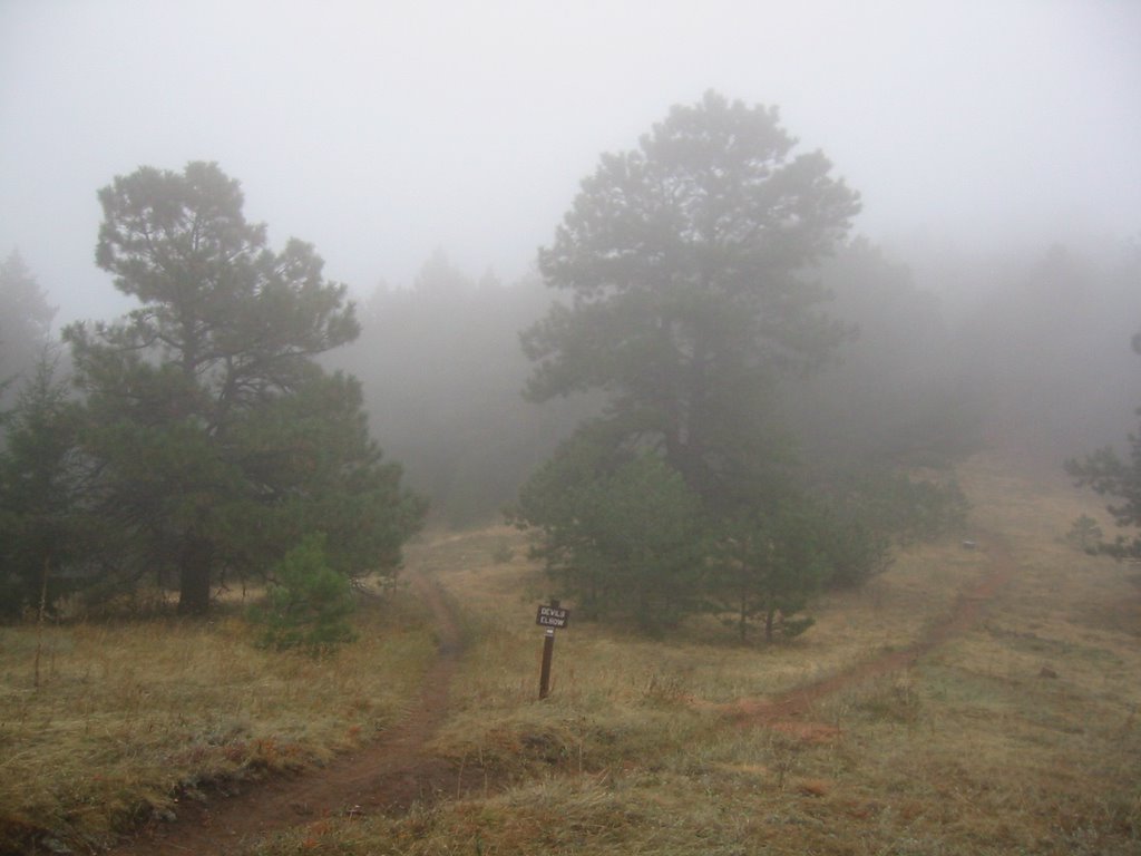 Elbow. The route goes past the very cool Walker Home Ruins, then down the Meadow Trail to the Old Ute Trail (photo 1 go up and left). You then do the loop around the Devil's Elbow (photo 2 go clockwise) and return the way you came (photo at bottom).
 This only gives you a 3.8 mile run, so I decided to extend it by taking the Parmalee Trail (photo 3). This trail descends at first, then skirts the slope providing some nice views, and finally ascends to get those quads burning at the end. About half-way on this trail I met up with six does and a small buck (photo 4). The deer here are very tame and let me get quite close. They were grazing within 10 feet of me and weren't spooked at all.
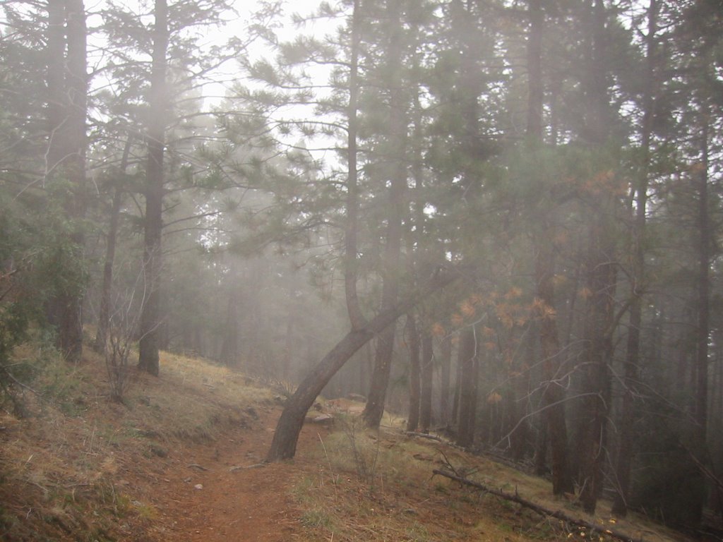 This was the first time I tried taking my camera with me on a trail run. It worked out okay by stuffing it in my small runner's Camelback fannypack. Next weekend I hope to do a bit more scrambling if it doesn't snow too much. The week after that is elk hunting season!