Wednesday, December 05, 2012

Elk Hunt 2012 Part 2 of 2

On Thursday we decided to finally hunt the towers.  Two in our party went over to the next ridge west from the tower ridge.  Two went to the bowl, and I went to the top.  We got in early and I was up to Dalton's rock before 7 am.  As I scoped the mountain side from the next rock on the ridge, I spotted a bull elk high above and to the right of the mudslide.  I devised a plan.  I would make my way through the oak brush at the lower end of the slide, then sneak up the soft mud to avoid detection.

Dalton's rock
My plan was working out perfectly as I detangled my way to the bottom of the mud slide.  The side ridge of the slide made a perfect visual barrier and the soft dirt was very quiet.  I poked my head above the ridge about half way up, but couldn't see the elk.  I proceeded on to the next chosen vantage point, but again no elk.  I was beginning to think the bull elk I had seen from far below was in reality just a boulder or something.

In my sights
As I made my way on up, peaking over the ridge, I finally came to the full view.  Two spike elk!  They were bedded down in a small opening just 30 yards away.  They had no idea I was there.  Man, did I wish one of them would grow some bigger antlers!  I scoped each of them with my rifle, and watched them with my binoculars for over a half hour.  They were very on edge, perking their ears and nose to every little change in the breeze.

Two spikes
Finally, I decided to move on.  Although quiet, when I did stand up, they immediately detected my presence and spooked.  They crashed through the thick oak brush and seemed to have some difficulty making their way through.  It was good to see it isn't always humans that find this stuff annoying.

I made my way to the top of the mudslide and to the spot I had shot at the bull a few years back.  The only way through the thick brush and back to the ridge, was up over the top of Indian Point.  I finally bagged this sucker after many years of hunting around it.  Nice view.

Indian Point
On Friday, my last day of the hunt, we finally got snow.  I decided to hunt the middle section of the Blue Grouse Trail.  I started up through the meadows about a half mile past the Point Camp Trail hoping to make my way up to the dark timber pockets below the rim.  As I rounded a large bend in the path, I spotted two cow elk.  As I readied myself for the first shots of the season, I spotted a nice bull.  Probably a five point, so I knelt down and tried to steady my aim.  I let the lead fly, but missed!  Another shot and another miss just low!  Damn.  Now the elk aren't hanging around any longer and they take off up hill.

Where the elk were
I tracked these elk all the way to the top of the mountain through some steep side hills and a lot of thick timber.  Even though it was snowing on and off all day, at times it was hard to find tracks.  At one point I had to back track and get my forgotten fanny pack.  They led me through the timber and finally into the upper rolling meadows of aspen groves.  Finally at midday the tracks became too hard to follow.  I never seen the elk again.

 
Where the red fern grows
I promised myself I would practice shooting my rifle at longer distances: 200-300 yards, at least once per month for the next year.  I can't miss another shot like that again.  They are too few and the hard hiking it takes makes it silly not to be able to finish.  I want you dear reader to keep me honest in this pledge.

Tuesday, November 20, 2012

Elk Hunt 2012 Part 1 of 2

Saturday opening morning we hunted over to the end of the road on upper alkali basin.  Clark came with me, a first time hunter.  On the atv ride up we road double up the very cobby road from dry basin where we were camped.  There were many hunters over in this area, and we spent the morning trying to make our way to a place of our own.  Clark got to experience crawling through the oak brush and tip toeing across boulder fields.  In the end we walked right up on two hunters watching a meadow.  We walked on until we came to the long park where Dalton shot his bull elk. 

I left Clark on a high perch to watch as I walked down through the park to the far ridge.  I decided to hug the lip of the park so I could see down into the basin.  As I got 3/4 of the way, I spooked something in the bushes ahead of me.  It didn't sound like a deer, and it definitely wasn't an elk.  I made my way to a small hill to see, and surprise! a mountain lion!  Very cool to see her sleeking into the foliage away from me.  As I walked a bit further, I heard more rustling.  I got a bit spooked thinking I was the hunted this time.  It turned out to be deer this time, not mountain lion.

I hunted up around to the right of the high point on the far side of the park.  There isn't much visibility up here and is quite noisy with all the brush.  Sticking to the open face of the point works just as well.  As you get to the far side you can see down into the ajoining basin and onto some secluded parks.  I didn't spot anything and made my way back to Clark by early afternoon.

We hunted from the end of the lower road that evening.  We spooked a deer right as we came to the lookout point, but spotted no elk in the far basin.
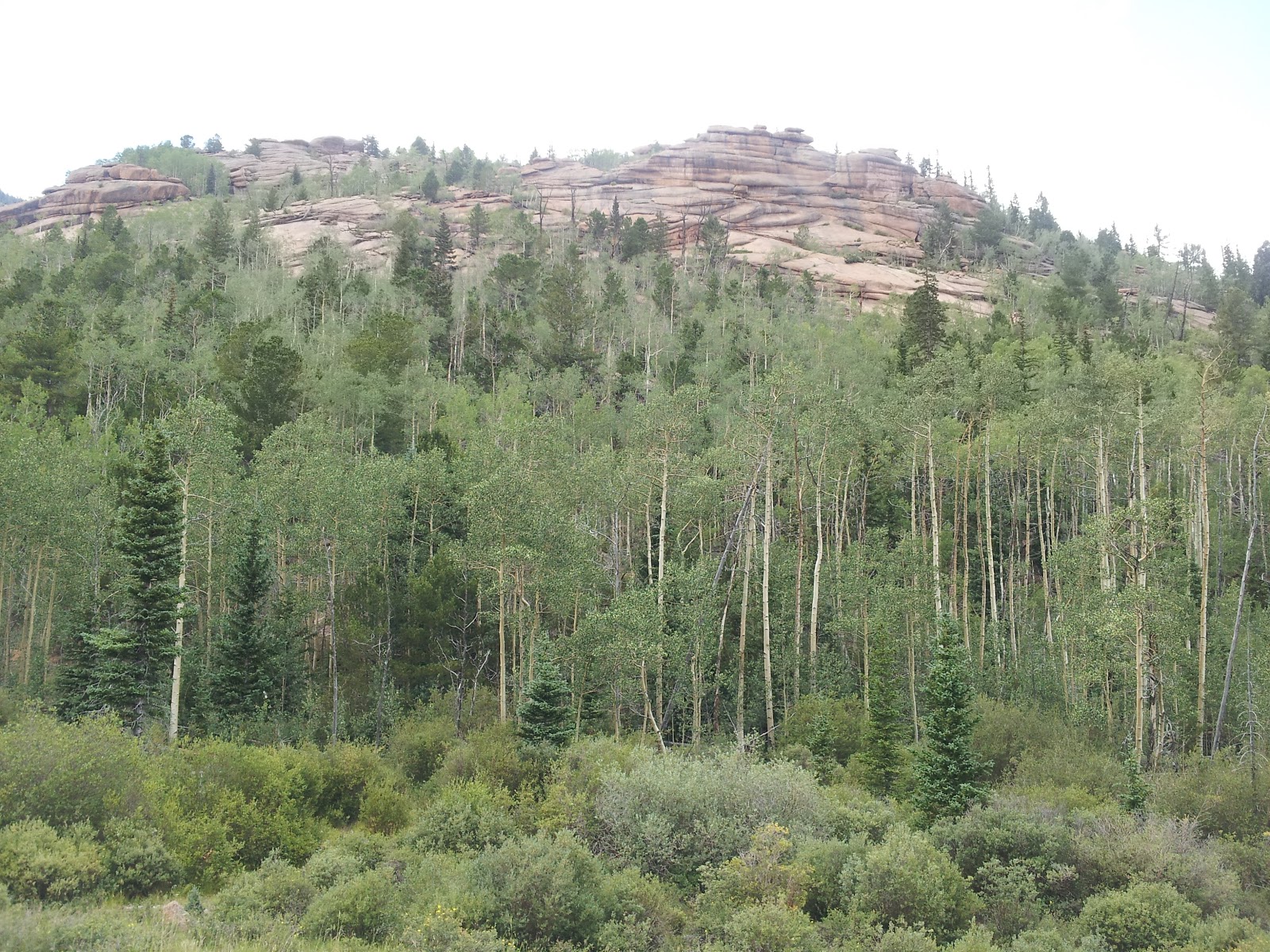
mossy creek
The other boys in my hunting party said there were way too many hunters along the dough spoon road, so I decided to go to the end of the blue grouse trail.  I parked at the base of the mountain, just before bull and brown and hiked up the road to start.  I found a service atv road to the right, not open to the public, but legal to hike.  A perfect option to hunt quietly.  It was a very nice hunt, but alas no elk.  I met three hunters coming down from the top, so I know you can get there from the granbys.  I hiked out through a nice park back toward the ridge in order to make a big loop.  I seen a very nice 4x4 buck and we did a little dance.

arrow in tree
On Monday it was just Clark and me.  Dave and Steve had to work, and Chip was not feeling well.  I tried to set Clark on the point camp trail, but screwed up and sent him up the road to that camp.  I road my atv to the first open park almost to the top of the bull and brown.  I hiked out staying at the same elevation.  After about an hour of hiking through aspens and pines, I spooked a nice bull elk.  He ran straight away from me knocking his antlers on the aspens.  I couldn't get a shot.  Shortly after, I heard another hunting shoot four times.  I didn't know how to proceed with my hunt.  After half an hour I heard two more shots, then another half hour one last shot.  In the end I hunted by following a circle where I believe this other hunt went on.  It wasn't a winning strategy.  Later that day I did come upon fresh blood.  I followed it through the thick evergreens and eventually spooked a couple of elk.  With no snow, it was very hard to follow the blood and it seemed to disappear.

spot the hunter?
On Tuesday I got Clark on the proper point camp trail, and I again hunted the same place.  And again after about an hour of hiking, I spotted three cows.  I could just see their heads.  I came to a well traveled game trail and followed it.  It lead to the upper meadow where the b&b atv trail meets the greenwood trail.  In reality this hunt area isn't that far from atv trails.  I decided to try to enter the pines, but soon found myself in a boulder field.  I was meticulously making my way down the boulder field when I mistakenly stepped on a twig.  I heard an elk in the timber take off.  Damn!  Hunting elk is an exercise in staying alert.  One small mistake can ruin hours spent on a hunt.  But I did find a new way to hunt the dark timber on the Grand Mesa.  I tried to go as far out as possible and came to some huge meadows with many quakies.  Eventually I came to the place cattle make there way down the mountain.

Wednesday brought Steve, Justin and Dave back to camp.  We decided to give b&b one more try since I had seen elk both previous days. We all parked in the same meadow, but Steve and I went up the road to the large park on top.  Steve entered where I had come out on Tuesday, I went farther and it took awhile to find a way in without getting into the thick timber.   The area always looks different based on the exact small rolling meadow you are in.  I met up with Dave late morning and nobody had seen elk.  When we got back to the atvs, we found Steve napping.  Dave used his elk call, but Steve didn't budge.  Dave let out a huge bugle and Steve jumped up!  A good laugh was had by all.
see the porcupine?

Late in the day Steve and Justin went back down to pick up Clark who was hunting the low end of this area.  Dave went up the service road and I hiked down blue grouse trail.  I was about an hour in, when I spotted many deer.  The hunting got really good.  Finally I spooked some cow elk.  There was a bull with them!  A spike... damn.  At the same time, I seen a porcupine.  He waddled away up a small trail.

Stay tuned for part two!


Wednesday, October 24, 2012

Elk Hunt 2010

Opening morning, two nice bucks.  Quakies across the trail.  Hunted down and around.

Day two hunted the radio towers.  Went all the way to the top, seen a bull elk at 3 pm across Well's Gulch from just above Dalton's rock.  Seen a bear who bird dogged for me.  Steve seen a bobcat.

Day three we went up top to flowing park.  Dave, Justin, and Steve went to the end of the road and shot at some cows 700 yards.  I hunted the crunchy snow on the road to point camp.  Forgot my fanny pack.  Hunted the ridge... didn't see any elk below me.  Hunted down by xx lake.  Steep drop off, no way to hunt down.

Day four it was snowing hard.  Hiked up the ridge on the far side of Alkali Basin, but the blizzard turned me around.  It let up a bit so I wanted to hunt the bull I seen on day two.  Beautiful basin, but no elk.   I watched the park where I seen the bull, but didn't spot him.

New binos are great for seeing elk.  Day five Dave and I shot at some cows from the honey hole.  Dave followed a wounded cow for three miles.  I hiked up, seen a bull up high.  Made my way through the oak brush, then tracked him for a couple of hours.  Back down at Dalton's rock, I seen four elk up at Indian Point.  A doe followed by a little buck came into the park below d rock.

Day six Dave and Steve hunted from the cabins and I hunted from Point Camp.  Seen evidence of a bull, but seen no hair.  Drove to the end of blue grouse for lunch.  Decided to load my gun and spotted 30 elk on the hill above.  Took some long shots.  Tracked them across and down to the raging creek.

Day seven, Steve hunted low and I hunted the end of Blue Grouse again.  Went straight across along a trail, up the far ridge and along the ditch bank.  A plane scared the elk.  I seen evidence of many beds.  Decided to ride the ATV up the road and spotted some cows.  Took one shot.

Day eight we had to be out of there to go to Phoenix for the race.  Steve and I made it around the downed trees and to the end of the road.  My advice is to take the lower spur.  The horse trail is a much easier hike than up the ridge.  I spotted the bull on the next ridge and made my way across the basin.  I got within 400 yards, but too much oak brush to get closer.  Took my shots and dusted his ankles but couldn't draw blood.


Drive to Phoenix took all night.  I drove from Mexican Hat.

Lost Creek Wilderness Loop

It has been a while, but finally got out and hiked with my Colorado Trail partner Nick.  He has been exploring the Lost Creek Wilderness in Colorado and invited me along on an epic hike of 22 miles (some posts say 26 miles... I didn't bring my gps: mistake #1).  Of course Nick wanted to do it all in one day: August 18, 2012!

We got to the trailhead early and headed out.  Due to the length of the hike Nick was worried about finishing before dark so he set a blistering pace.  I almost broke into a trot to keep up.  There were many cars in the parking lot and quite a few folks in the first couple of miles, but we soon found solitude.   The picture above shows a typical Lost Creek scene of monuments.
  
 We came upon a nice campsite near the spot of the failed dam and old buildings.  We also seen the first hikers we had seen in a while.  Nice quakies.

Goose creek starts to become lost in this area.  We witnessed the tunnel where the creek makes its way through the rock and a man sitting lotus position meditating.  Very spiritual and feng shui.
At the top of the pass you see refrigerator gulch.  I'm not sure where it gets its name, but there are many monumental rocks in this fine wilderness.  Here is where I started seeing many mushroom species.  I'll post pictures later.
Approaching McCurdy park we were far from civilization and had not seen another person for hours.  My dogs were barking and we were only half way.  Serenity is in abundance here.
How about a nice combination of aspens, pines, and granite?

How about my ugly mug?  Hiking in my approach shoes, but why not.  Don't tell anyone, but fly agaric in this area.
Long before you reach this lovely rock, a word of extreme caution: you will reach the massive blow down of Lake Park trail.  There are so many trees blown down that you are in for one hell of a bushwhack.  It is easy to get lost here.  Funny how the wilderness rules work: no chainsaws, so it will be awhile before this trail is nice again.
Proof I made it.  The hike to the top of the pass after an unwanted set of switchback descent sapped me of any remaining energy.  Plus we still had six miles to go.  The long gradual descent back to the truck was enjoyable despite my tired feet and empty tank.  Here again you see the unique beauty of Lost Creek Wilderness.

Saturday, August 11, 2012

Ellingwood Point Southwest Ridge

We met Brian at the trailhead for the road to Lake Como deep in the Sangre De Cristo mountains.  Due to a flat tire, we started up the road very late in the day.  Add to this that I didn't feel comfortable taking my stock 4x4 as far up the road as I did in my Little Bear ascent.  We ended up hiking most of the way to Como in the dark.  We got to Lake Como at midnight and pitched our tents.
 
I originally had planned to do the Little Bear to Blanca traverse, but Shelz was not comfortable with such a committing route so early in her scrambling life.  Instead we decided to try the Southwest ridge on Ellingwood Point.  Roach describes it as a fun and continuous tune up for Little Bear to Blanca, and so it is.

We hiked passed the recommended start, and so I decided to take off from the next lake up.  This approach to the ridge proved to be a bit harder scramble.  At one point we spent the better part of an hour trying to get around a particular vertical rock section.

Finally once on the ridge, the scrambling is solid class 3.  Often times the ridge looks like it is too hard, but you can always find a reasonable weakness in the slope.  If the rock gets too vertical, you can always drop to the left side of the ridge.

Once you can see all of the final approach, things get a bit airy.  The ridge narrows and you must keep your balance.  A couple of knife like edges exist here.  Just before the final pitch, we found it necessary to downclimb and then scurry up a loose rock and dirt section to the last notch on the ridge.

The scrambling up to the summit was easier both in climbing and in route finding than the final pitch on Sneffels.  We had the summit to ourselves and hadn't seen a soul on our route all day.  Even the descent was us alone.  The 14er initiative volunteers had even quit for the day.

The descent down the standard route was an exercise in talus hopping.  Once we made it to the cave, the descent was easier.  The long slog back to camp was highlighted by the sighting of four nice mule deer bucks.  Two of the fellas had quite large racks, while the other two were younger.  All still in the velvet.

This route took us from dawn to dusk.  It took us over eleven hours, granted we were moving slow.  This was one of the most fun scrambling routes I've done.  It wasn't the hardest, but the continuous fun is hard to beat!

 
Initial Ramp

Our harder scramble

Balancing on the ridge

At times on the east side

A long way down on either side

Finally, the rest of the ridge to the summit
Little Bear in the background

Final pitch

39th 14er

A look at our first pitch

A look at the recommended start

Sneffles Southwest Ridge

Shelz and I decided to brave the Class 3 Southwest Ridge of Sneffles on a fine July weekend.  We arrived Friday night amid a hail and sleet storm.  It was so wet that we decided to sleep in the pickup cab rather than try and set up a tent.

We woke after an uncomfortable sleep and took the truck up the 4WD road to a point just below the lower trailhead.  The hike to Blue Lakes pass was very picturesque and enjoyable.  Once up the switchbacks you get a glimpse of the ferocious gendarmes that guard the start of the ridge.  Luckily these are avoided on the west side.

Once past the gendarmes the ridge progresses steadily from hard class 2 to easy class 3 to harder moves.  This was Shelz first big class 3 outing so it was a descent choice for a noob.  She tackled the climb with aplomb.  Route finding was even a test as you pass to the east side and do a bit of descent via a notch in the ridge.

The climbing continues in a fun fashion until you see the final pitch.  The climbing became a bit harder here due to the line we took.  A couple of times we had to retreat and find another way up.  Shelz even slipped once providing a tense moment.

The views on top are amazing.

Our descent followed the standard Sneffels route.  At top it is still some class 2+ ridges but then descends into a nasty scree and dirt slope.  Shelz decided a dirt and mud glissade was best for her.


The shelf road on the way out is crazy for sure.  Once down into Ridgway we stopped at Colorado Boy for a brew and a souvenir T-shirt.  A great adventure in the San Juans!