Saturday, September 29, 2007

Long's Peak - Clark's Arrow

I had three goals for this summer: Mount Elbert, Mount Evans, and Long's Peak. This then is the crown jewel of the summer, and as it turns out, for all time. Climbing Long's is a spiritual experience unparalleled. My general philosophy is that one should seek out new experiences and try different mountains, but Long's is such a unique mountain that I hope to return many times.

I got a bit of a late start arriving at the trailhead at 5:30 AM. Most books recommend leaving at 4 AM in order to get off the summit by noon. It turns out that Clark's Arrow route is shorter than the Keyhole route, so a 5:30 start is just fine.

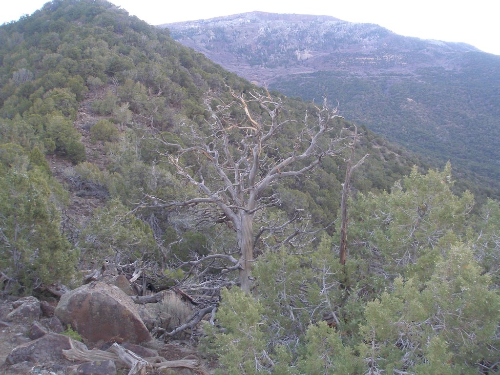
I passed a few parties on the trail up the the junction where Keyhole and Clark split ways. Just before the junction I spotted a herd of elk just above tree line. Quite a scene and the start to a great day. The scramble up to the Loft was fun but not great. The climbing is not sustained and just not quite steep enough to be truly engaging. There is a ledge just before the final ascent which provides an escape route to the left. I've read that in some years there is snow and ice year round on the loft which would make it more challenging. On August 5, 2007 there was no snow, so an ascent straight up and to the right of the loft might have added the kick this section needed. Nevertheless, the views of the Ship's Prow from here are amazing.

Once on the saddle between Meeker and Longs I followed the white rock piles leading to Clark's Arrow. I wasn't confident about the weather so I decided a detour to Meeker's peak was unnecessary; I am not chasing the 13er list anyway.

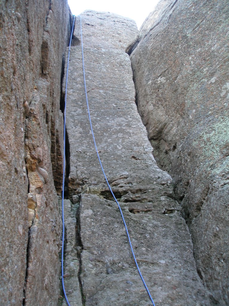
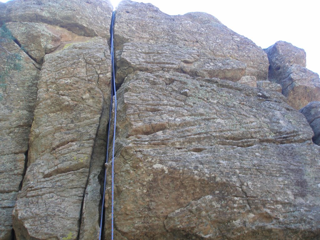
When you get around the corner to the back side of Long's Peak the crux is near. The down climb here is challenging and fun. Once past the Notch Couloir you start to see climber's on the home stretch. The climbing here can be made more challenging if you desire.

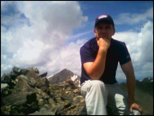
The homestretch consists of two cracks loaded with people going up and down. My advice is to off route and bypass the crowd rather than waiting your turn. The summit has exhilarating views in all directions. I even met a guy who came up the Kliener's route (a route I hope to take one day with the guidance of the Colorado Mountain School.) One thing about the girls you see on peaks: most are quite shapely!

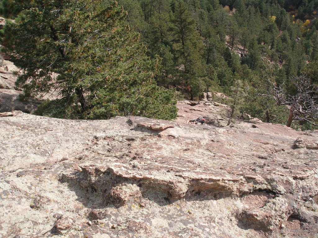
I decided to make a loop of it and take the Keyhole route down. Once I was back down off of the homestretch I got behind a couple who were descending very slowly. There isn't much room to pass without being rude, so I chilled and enjoyed the scenery. The trip across the narrows would be a bit nervewracking for someone not used to such exposure (see picture). At the top of the trough I seen my opening and bypassed the slow-pokes. The climb down the trough is somewhat loose, but otherwise uneventful. There were still people coming up and it was getting on to about 2 PM.

The trip along the NW ridge to the Keyhole provided more alpine experience as I didn't encounter any other climbers. Encountering the Keyhole for the first time is cool: it is quite a rock formation. From the Keyhole you descend the boulders to the boulder field, then it is simply a long hike back to truck.

On the way back I saw some ptarmigan (quite tame) and seen a middle aged woman who had sprained her ankle. Not good as she was still 5 miles from the trailhead. One last cool thing about the Long's Peak Trailhead: no charge to park here! Very nice.

Saturday, July 28, 2007

Bierstadt to Evans - Sawtooth Scramble

Matt and I bagged two fourteeners and scrambled the Sawtooth ridge on Sunday July 15th, 2007. It was a great day and a great to spend time in the mountains with my son Matt. He has become quite a 17 year old mountaineer.

Getting to the Beirstadt trailhead at the top of Guanella pass, we were delayed for a short time by construction on the road. Once at the trailhead we noticed one thing: lots of people climb Beirstadt. I would guess it is top 5 along with Gray's.

Crossing the willows is no longer the adventure it used to be. The trail and planks now make it easy. The trail to the summit is uneventful, yet quite scenic. Close to the top is a snowfield to cross and a bit of Class 2 rock scrambling. This was the goal of most of our fellow climbers, but Matt and I were just getting started. After sharing a Busch NA, away we went!

The ridge between Bierstadt and Evans is called the Sawtooth. It is aptly named and recommended by Colorado Scrambles. The first half of the Sawtooth requires quite a bit of downclimbing. Although challenging, it is less fun for me than climbing up. Matt took the lead and did a great job of route finding. Just past the low point of the ridge the climbing gets more intense. Matt scrambled away and I lost him. As I climbed the steep rock I started to worry more and more. I have told him not to get separated, but you know teenagers. I met up with some other hikers with a dog, at this point they had to turn back because it was just too steep for Fido. Don't bring your dog on this route: humans have this advantage over dogs. It turned out Matt didn't get too far ahead and was waiting for me at the top of a nice pinnacle (not the one pictured.)

We were killing quite a bit of time, so Matt convinced me to leave the standard route which circles the last cliff to the left (NW). Instead we headed straight for Evans, circling to the right above Abyss Lake. Leaving the recommended route is something that experience has taught me is usually not a good idea. In this case the obstacles included some boulder hopping, loose rock and especially one snow couloir that was impassable without crampons and an ice axe. We decided to climb further down to go around the snow rather than risk it. Finally we decided to climb a gully which got us back into some fun scrambling. We again gained the ridge and met up with the trail to the top of Evans.

We were quite tired by now, yet trudged on to the summit of Evans. We started to hustle a bit because the clouds were rolling in and the day was aging.

On the descent from Evans we again deviated from Dave Cooper's route to Mount Spalding and instead headed straight down the creek. Following the creek is the only way to avoid the cliffs of the Sawtooth. The trail was steep and loose plus it started to hail pretty intensely. Luckily we were prepared with light coats which we donned. Once we climbed down the cliffs the weather cleared up and the day was beautiful again. The only problem was the two or three miles of swamp and willows to cross. There is a nice path through the willows so it wasn't too bad and we passed a nice waterfall. Matt and I talked about how we might hunt this valley and I tried to give him some pointers on how to hunt.

As we reached the Jeep it started to downpour again, so we were feeling relieved to be back. All in all it wasn't my favorite scramble and it was a very long day. We probably covered 10 miles.

Mount Elbert Scramble

On July 4th, 2007 Matt and I climbed the tallest mountain in Colorado: Mount Elbert. While Mount Elbert is the tallest at 14,333 feet, it isn't the hardest mountain to climb. The normal route is only a Class 1 trail. We left Denver at 6 AM and arrived at the trail head at 9 AM. We got a bit of a late start, since normally you want to be off the top of peak in Colorado by noon to avoid thunderstorms and lightning.

Matt and I decided to make the trip a bit more interesting by following a variation of this route up the gully on some Class 3 rock. My focus is not to climb all the 14ers, rather I am interested in climbing all of the scrambles in Dave Cooper's Colorado Scrambles book. On the other hand it is surprising that it took me over forty years to bag this peak!

I must say this scramble was as much fun as some of the scrambles in Cooper's book (photo at left). The climbing isn't sustained, but is long enough to be as good as the Kelso Ridge on Torreys. Dave explains in his book that there are thousands of Class 3 climbs in Colorado's mountains and he couldn't include them all. He also purposely left some classic climbs out. While not quite a classic climb, I suspect he left this route out to protect it from the throngs of people who might want to bag the biggest and get in some scrambling. My advice is to always look for adventure and not to rely on documented trails all of the time (all while respecting nature).

The route to tree line is sustained elevation gain, with some steeper sections. At the start you follow the Colorado Trail, so I completed a small bit of that goal. About a half mile above tree line we left the main trail and headed for the small lake. I believe you could make the climbing above the lake as difficult as you want: easily 5+.

Above the cliffs is the false summit where we rejoined the trail. Matt was getting pretty tired at this point and he vowed to take a nap on the summit. Arriving at the summit we encountered a light crowd. The views of all the mountains surrounding Elbert is amazing.

The descent seemed very long. Matt smoked me on the way down, so I guess that nap was a good idea!

Saturday, July 14, 2007

Flatiron Scramble

Matt and I took a trip up to Boulder for a day of scrambling. Our goal was to climb Angel's Way which Gerry Roach's Flatiron Classics book describes as mostly F3 with a few F4 cruxes. F4 translates to a 5.0-5.2 climb, but we were going to see if we could make it over the cruxes without ropes.

We approached Angel's Way via the Skunk Canyon Trail as I understood from the book. I was glad we took this route for the adventure, but it is not the most direct approach to Angel's Way. Instead you should just go to NCAR and take that trail.

As it turns out the whole area around Angel's Way is blocked until July 31st for raptor nesting. So Matt and I decided to just head over to the Shanahan crags.

I was a bit disappointed because I thought I had thoroughly explored the Shanahans, but I was in for a pleasant surprise. Last year I had tried to climb the northern most Shanny, but it proved to difficult. This time we started farther north on the rock, just passed the Slab.

The scrambling on the second Shanahan is very similar to it's brother, but a little more intense. You can make it as hard as you want; well up to 5.1 I would say. The route is punctuated by a vertical cliff that looks climbable, but with ropes (see picture). Instead we traversed south for 100 yards and then back across polished rock to bypass the cliff. Matt went on up, but we weren't sure of a walk-off from the absolute top, so we decided to descend near the area of the cliff. We found an escape off the south side of the rock by passing under a chock stone (picture without people).

We then walked up and around this rock and found another piece of scrambling rock above the Shanahan. This proved to be fun easy scrambling to a nice summit. We planted a dead stump in the pothole at the top as our flag.

Walking off we found a very nice hidden cave on the south side of the Shanahan rock. It looks like a great place for a guy to bring his girl ;-)

We will be back in late August to attempt Angel's Way again. Stay tuned.

Saturday, December 23, 2006

Elk Hunt 2006


Camp Wells Gulch
For the first time in ten years I missed opening day of hunting season. Dave and I actually missed the first two days because we were at Lake Powell. I had not been to Powell in a few years so it was good to get down there and do a bit of fishing. It was a great time and very relaxing.

So my first hunting day was Monday and we hunted the radio towers. I went to Dalton's rock via the ridge trail, but seen no elk.

Tuesday we again hunted the radio towers and I went to second notch. Down in Well's Gulch I saw a cow elk and took a shot. I hiked down in the bottom but found no sign of her. I then hiked all the way around the gulch and back down to camp. This year we camped in Well's Gulch rather than on Peterson Mesa. That evening we took Steve's jeep up the road to the right that end at the bottom of Alkalai Basin. Dalton shot at a herd of elk crossing a meadow, but missed. We can't keep missing shots!

Wednesday we went back and hunted the meadow where Dalton shot. I went across the valley and up the far ridge. Dave hunted up the ridge to the left that defines Well's Gulch. Dalton watched the meadow all morning. I seen quite a few deer up on top in the thick pinions at the end of the Alkalai Basin road.


Thursday we got snow which should have helped the hunting a bunch. We took the ATVs up the Delta Airport road. Dalton and I hunted the top of Alkalai Basin, Dave took the bottom. We seen a big buck, but didn't shoot it because we had no tag. In the afternoon we went over to Bull&Brown and met some guys shot a couple of bulls up that trail. We tracked some cows but eventually lost their trail. On the way back my ATV ran out of gas. Dave had to push me all the way from the top down to the airport. Major bummer.

Friday we still had snow so we went back and hunted the far ridge at the Radio Towers. I saw mountain lion tracks which was cool, but no elk. No actual elk that is, there was plenty of elk track going every direction. I came very close to the herd according to Dave, who was spying from the main spot on the Radio Towers trail. Dalton again missed shots way low almost to the desert.

Saturday Dalton watched from our main spot on the Radio Towers trail. At 11 am Dalton spotted two cows in the lower park, but he missed. I hiked around and down in to see if I could spook them. My feet were really sore hiking back out.

Sunday I took the point at our spot, Steve took middle and Dave stayed on ridge. Dave shot a cow. I shot at a bull and missed. Pack out was fairly easy. I definitely need to practice shooting more and in different situations. There are a lot of elk in our area, but you need to make the most of the shots you get!

Next year I'm getting my bull.

Castlewood Canyon - 2nd Trip


On our second trip to Castlewood Canyon we decided to tackle the 5.8 climb just as you reach the Grocery Store wall. This climb proved to be great fun. The start looks harder than it is. Then the crux is about 15 feet up. I used my knee to help mantle up to the first ledge.

The second half requires a bit of a left traverse. There are some nice hand holds that then lead to an under grab to get to the top.

We then climbed a crack that is down the trail to the left. This crack was an easy and not very interesting climb. Since we had taken the time to rope it up I climbed both cracks and then tried to straddle climb it.

Finally we went around the corner to the right. The rope slid into the crack and after a couple of times trying to rig it we gave up. Some of the eyelets on the top are missing so there isn't a good way to rig the rope.

Castlewood Canyon - Grocery Store Wall

Sean and I decided to do some roped climbing in Castlewood Canyon. It was my first roped climb outdoors. After years of scrambling and over a year of gym climbing it was about time. We decided to go to the Grocery Store Wall and picked a couple of climbs to warm up with.

We had some trouble identifying the climbs, but picked what we thought was one of the easiest climb on the wall. I believe we climbed Peaches and Scream which is rated 5.6. You can check it out over at Mountain Project. It is listed as a trad climb, but you can top rope it.

It is fun easy climbing until the crux. About three quarters of the way up there is a slight overhang of rock that doesn't have an easy holds. It requires a bit of friction and a bit of faith for a couple of fourty-somethings who are not rock gymnasts. Basically you need to be comfortable with dynamic moves to get past this piece of rock.

We then went around the corner and practiced on the far side before the wall breaks up. The climbing was more my level here and we had fun. The rock is a bit jagged in places here and I nicked my brand new rope. Check out the picture and tell me if you would climb this rock.

I had a great day climbing roped for my first time! Thanks, Sean.

The Second FlatIron

Sean and I decided to scramble the second flatiron of Boulder's famous FlatIrons. Matt and I had done it a couple of times this summer, but it is a fun climb so I was happy to return. To approach from Chautauqua Park simply follow the guide signs to the 3rd FlatIron. Before you reach the third, you will come to a sharp switchback with a rock face sloping to the sky. It is not marked, but this is the start of the 2nd flatiron.

One of the joys of the second is that you never take the same route twice. Sean says that it isn't much different than Third FlatIron climbing. The third just doesn't have an easy escape from the top.

I divide the climb into 3 sections. First is interesting scrambling on fairly steep rock. When this rock is wet it can be quite challenging and I would not recommend free climbing.

Second is the crux with a tricky move or two. As you get up a couple of hundred feet the hand holds get farther apart and some friction moves might be necessary.

Once you are past the hardest section, the climbing angle eases a bit, but you climb yourself to a point. You can take a flying leap from this point over the gap to the other side or you can down climb a bit and escape to the other side that way. From here the Pullman's car soars above you as scramble easily to the top.

The Keel


In September I met up with a new climbing partner named Sean. He was searching online for FlatIrons and found this blog. None of his other buddies wanted to do any scrambling so we decided to hook up.

On our first outing we decided to try the Keel. The Keel is just to the south of the Shannahan crags. The scrambling here is easy, but the wayis n ot obvious and the rock is broken. It was fun but not the best scrambling in the FlatIrons.

We decided to proceed up to Bear Peak. From where we were it required a bit of bushwhacking. The peak was quite windy, but the view is great. Sean is a cool guy and knows his stuff when it comes to climbing, so here's to more adventures together.

Saturday, September 09, 2006

Father Dyer Scramble


Matt and I took a trip to Summit County to climb Father Dyer Peak. The trailhead is 2.4 miles up Spruce Creek Road. Spruce Creek Road is 4.2 miles south of Breckenridge, Colorado. My camera batteries crapped out, so these photos were taken with my old cell phone.


The hike follows the Wheeler trail for about a half mile until you hit the Crystal Lakes 4WD Trail. Hike this road until you get to the cabin and lake. The scramble is now just in front of you.

This east ridge offers easy and fun scrambling all the way up. Matt took some of the more challenging climbs to the right of the ridge. This made me a bit nervous, but he had a great time. Check him out in this photo.

After eating lunch on top, we decided to descend to the left bowl rather than continue on to Crystal Peak (13,852 ft). We had much fun glissading down the snowfields in this valley! As we traversed back to the trail we decided to climb a coulior back to the ridge. This couloir had some nasty rotten rock that made for interesting scrambling.

As we returned to Crystal Lake, I found an arrow head. Quite unusual to see one above treeline. That native american must have been hunting mountain goats.

Just as we returned to the truck, the downpour started. There were quite a few people still going up the trail as we descended. I chuckled to myself thinking of them out there soaked in the rain.

The scramble is well worth the trip, but just a warning: the traffic is horrendous getting through Breckenridge and back to I-70. It took us over an hour to get back to the highway. Then of course I-70 is always busy on the weekends. Might be better to take 285 back to Denver.